How dreams of an English fiefdom in Central Bucks County faded away.
It’s easy to view New Britain Township as the stepchild of Doylestown, more like a pass-through locale on the way to the county seat. Very early in its creation, New Britain appeared destined for something special. At least that was the dream of a group of financial wizards whom I prefer to call the Gnomes of London. They wanted to create a vast manor to be known as “New” Britain in William Penn’s Bucks County. But the Gnomes – given plenty of time – never got moving.
To understand all this, let’s zip through history’s wormhole to take a look around.
London, 1682. The Gnomes – really a group of rich Quaker merchants from London and Dublin known as the Free Society of Traders – convinced Pennsylvania founder William Penn to sell them 20,000 acres in Bucks County in exchange for the Gnomes’ financial knowhow in managing his new American colony. The traders who never ventured across the Atlantic opened a Society field office in what is today’s Society Hill in Philadelphia and got busy stirring up controversy in the city that eventually gave them the boot. Still, the Gnomes retained that 20,000-acre reserve in Bucks.
To imagine the size of those holdings, an acre of land in Merry Olde England was equal to what a man with an ox could plow in a day. The land grant to the Gnomes, therefore, would amount to a swath of land that 20,000 ploughmen with 20,000 oxen could till in a single day. By modern measures, original New Britain was bigger than today’s Newtown Township (5,000 acres), Solebury (14,000), Springfield (4,000) and Bensalem (13,000). The Gnomes wouldn’t say what they had in mind. Insiders suggested a feudal English manor.
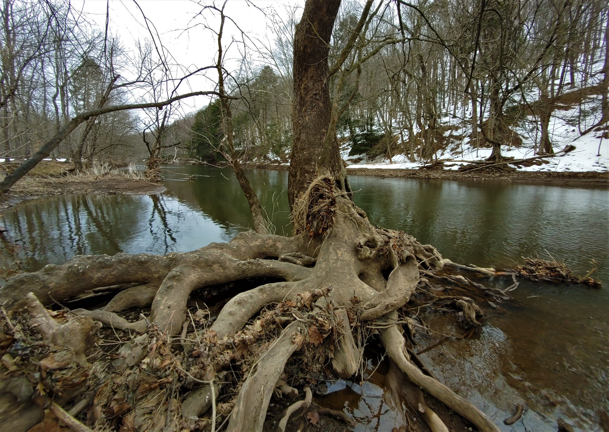
For nearly 30 years, the property lay undisturbed. Historian George MacReynolds theorized in 1941that Lenape Indians preferred living there even though tribal Chief Tamanend had deeded the property to Penn. The parchment described a massive track between Neshaminy Creek and Pennypack Creek in Montgomery County, stretching west “as far back as a horse can travel in two summer days.” Noted MacReynolds, “Indians still reigned supreme in this area while its surroundings were filling up with white settlers.” Tamanend, a friend of Penn and revered by Penn’s followers, happened to be enjoying his old age in New Britain’s forests and lofty overlooks above the ribbon-like course of the Neshaminy. It was idyllic for any poet but not particularly attractive to farmers. Of course, the Gnomes owned the territory and they weren’t selling.
Twenty-two years after Chief Tamanend’s death and burial in New Britain, the Gnomes decided in 1723 to subdivide and sell off their property to create New Britain Township. Among the first buyers were Welsh settlers from Delaware who established the villages of Chalfont and New Britain. They included Squire and Mary Boone who started a farm near Chalfont. Among their 11 kids was son Daniel born in Berks County (though there is some dispute he actually was born in Croydon). Danny became a famous Kentucky frontiersman who hacked out a road through the Cumberland Gap to open the Wild West to European settlement.
Back in New Britain, the land remained largely wilderness with an iffy boundary. Was it an oblong territory? Was it rectangular? How far did the borders extend? No one seemed to know. It was supposed to be 20,000 acres, rivaling contiguous Buckingham for largest in Bucks. Surrounding townships with surveyed borders nipped away. Hilltown, Warrington and possibly Plumstead partook, leaving New Britain with about 16,000 acres. That shrank to about 14,000 acres after the villages of New Britain and Chalfont became boroughs.
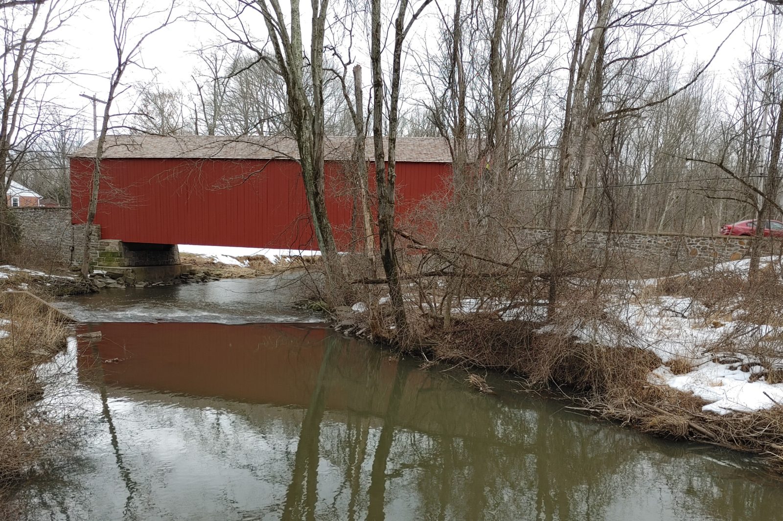
Doylestown became a township in 1819 and gobbled up New Britain’s southeastern corner adjoining Buckingham. That was more than a third of its neighbor. New Britain soldiered on, building a thriving township on 9,600 remaining acres defined by the borders of abutting municipalities. Today its steep hills, swift creeks, Peace Valley Park enclosing Lake Galena, the Pine Valley Covered Bridge, second oldest in Bucks, and its biking and hiking trails offer dreamy landscapes in which to relax.
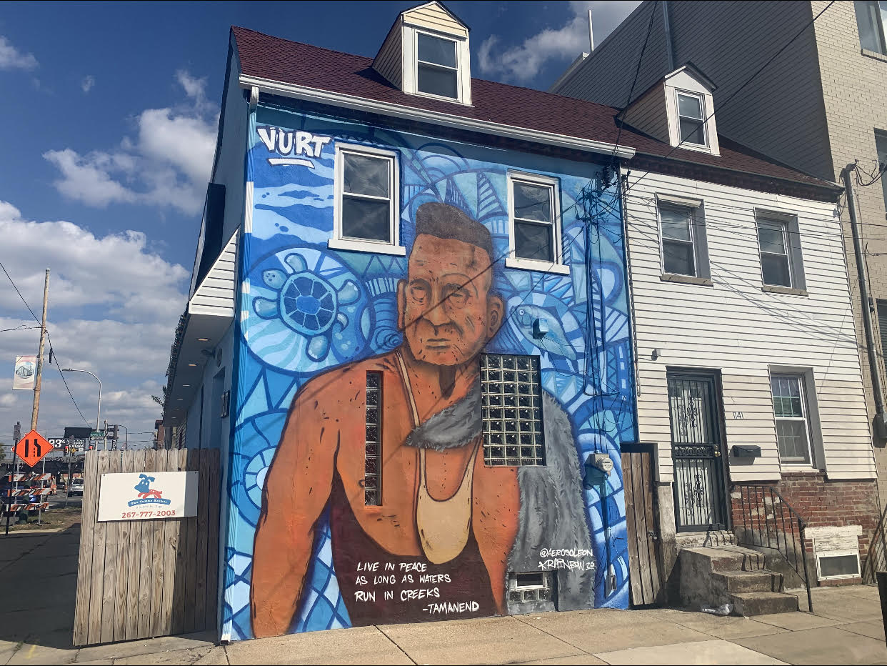
Not to be forgotten is the legacy of Chief Tamanend, buried in 1701 in a grave once marked by a large stone overlooking the Neshaminy in the township. The grave site disappeared after a farmer removed the boulder. The 13 original American Colonies referred to the chief as “Saint Tammany”, “King Tammany” and “Patron Saint of America” for the mutual trust he established between Native Americans and white settlers in Pennsylvania. Every May 1 was celebrated as Saint Tammany Day throughout the colonies. Tamanend Avenue in New Britain today honors the chief. In my opinion, the township should better promote its intrinsic connection to the man who helped William Penn make Bucks County and Pennsylvania possible.
***
Sources include “Place Names in Bucks County Pennsylvania” by George MacReynolds published in 1942, and “Free Society of Traders” by Lance R. Eisenhower in the Encyclopedia of Greater Philadelphia History. On Chief Tamanend, Julie Sky McCormick, the chief’s 9th generation great granddaughter, is working with partner Curtis Zunigha of the Lenape Center on creating a Facebook page called Tamanend Day 2021 to virtually celebrate Tamanend’s life. Efforts continue in the state Senate to re-establish May 1st as Tamenend Day in Pennsylvania. Julie can be reached at [email protected]