How a geologic and historic wonder in Upper Bucks met its demise.
In high school, my buddies and I formed a club we called the Merced Explorers to investigate underground caverns. Mom and Dad weren’t happy, to say the least. But youthful adventure as Boy Scouts prevailed.
Jimmy, Dave, Doug, Dennis, Bill, Jim B. and I used weekends practicing repelling and rope climbing techniques in the nearby Sierra Mountains in order to overcome challenges in limestone caves of the Mother Lode. That’s the area of the 1849 California Gold Rush east of Sacramento. Deep in the caves we occasionally encountered ancient wooden ladders and implements of miners of that era. In the glow of our headlamps, we’d stand in awe, imagining activity that occurred long before our time. That’s the fun of tactile history. You can touch and feel it to better imagine our favorite tales of Gold Rush writers like Bret Harte and Mark Twain.
It was that kind of intrigue in Bucks County that motivated David Steckel and his young friends in 1835. Dave grew up in the iron mining town of Durham in the northeast corner of Upper Bucks. With little nudging, he and his pals set off to find what was informally called Devil’s Hole north of town. The rush of air from the bowels of the earth and flights of bats enhanced its name. To get to the cave, the boys climbed over Rattlesnake Hill and followed Cooks Creek to where it joined the Delaware River. Nearby was the cave opening on a ridge line. The boys were surprised to find two barrels outside loaded with rock-encased bones.
Steckel described the scene 44 years later.
“I remember, on looking inside the barrels, seeing numerous other fragments of similar fossils. One of the party remarked that it must have been some time ago when these animals had been alive, to have their remains thus preserved in solid rock. We were informed later that this collection had been made by two gentlemen from New York, who had come on expressly for this purpose, to be forwarded to one of the scientific institutions there. This was my earliest personal knowledge of animal remains deposited in their original beds, and have thus reason to well remember it.”
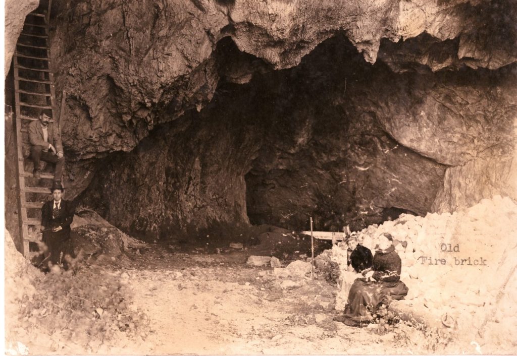
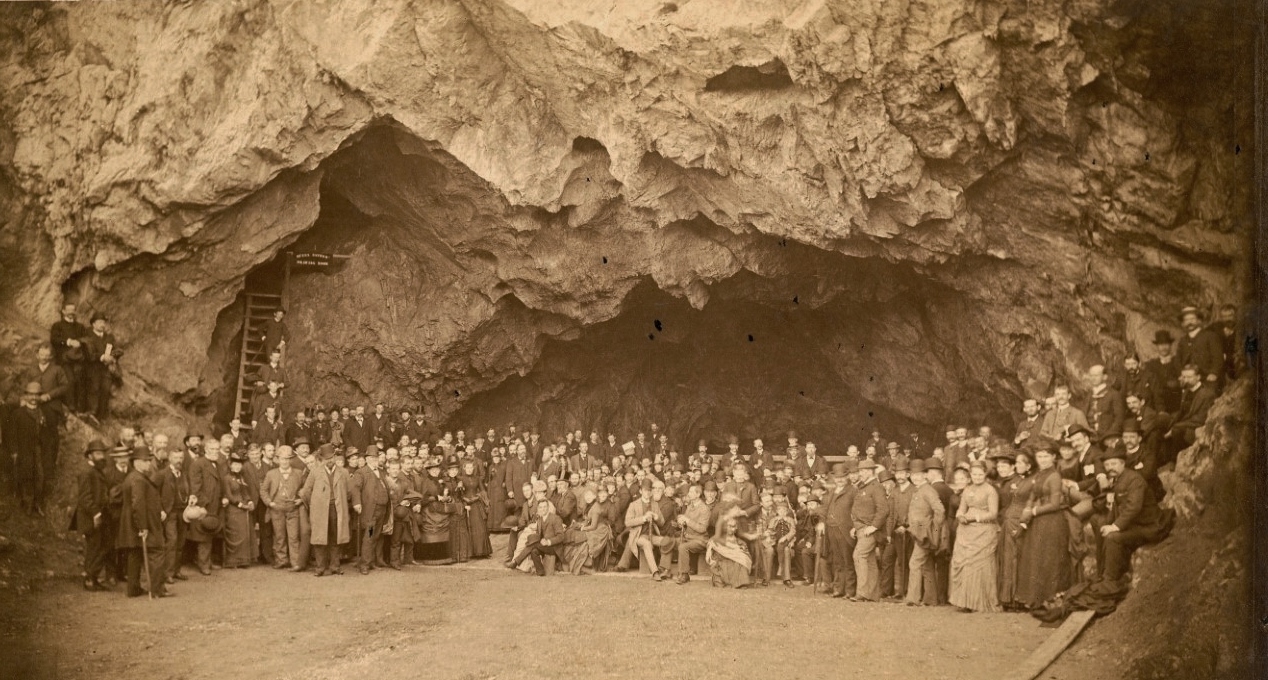
Whether the boys descended into the wondrous cavern remains unknown. But others did. They discovered three vaulted, stone cathedrals, each descending through tight corridors to the next, ending at a clear pool fed by an inaccessible subterranean stream. The largest chamber – called Queen Esther’s Drawing Room by colonists – was 160 feet long, 55 feet wide and 30 feet high. The name referenced Catherine Montour, a famous Iroquois Indian leader of the late 1700s who lived in western New York. What made Queen Esther’s Drawing Room particularly attractive was a crust of white crystal overhead. Additionally, there were extensive splashes of dark-colored stone looking like moss with water glazing it. Witnesses described the chamber as “startlingly beautiful” when illuminated.

It wasn’t the Iroquois tribe that inhabited the cave as it turned out. It was Bucks County’s indigenous Lenni Lenape Indians who made it home for centuries. The evidence was a large number of flint arrow heads, stone hammers, beads, pestles and parts of human skeletons littered about.
Before the Civil War, crowds of visitors came to Durham to experience the subterranean wonder, renamed Durham Cave. The tourist attraction wasn’t to last however. With the expansion of agriculture in New Jersey and Pennsylvania, entrepreneurs sought lime to fertilize croplands. Where better to find it than limestone hills and caves? Quarrying operations began around 1850, destroying the first two chambers of the cavern and clawing into much of the third. In addition, blasting on the hillside opened up an adjacent cave, revealing magnificent crystal stalactites. Within a matter of a few years, all were ground up and hauled away.
As the Doylestown Democrat reported on July 9, 1850, “Durham cave is being demolished, and its solid architecture of beautiful stone, broken up, burned and boated off (on the Delaware Canal). We suppose half of it is already gone and is now incorporated with the soil of thousands of the best farms of this and the adjoining States. In a few years the history of the cave can be related only by the oldest inhabitant. We very much doubt whether the rest of mankind can then be persuaded that such a cave ever existed in Durham Township.”
In 1993, archeologist Henry Chapman Mercer visited remnants of the cave and sadly remarked, “The end of a subterranean chamber (175 feet long by 40 broad and 28 feet high) opening upon a limestone quarry on the right bank of the Delaware River and surrounded by slag heaps – a sight to fill the investigator with regret – is all that is now left of the once celebrated Durham Cave.”
Sources include the Durham Historical Society and the Spruance Library of the Bucks County Historical Society; “Caves of Southeastern Pennsylvania” compiled by J.R. Reich Jr. in 1974 for the state Department of Environmental Resources; “An Exploration of Durham Cave in 1893” by Henry Chapman Mercer published by the University of Pennsylvania in 1897; and “Travels in the Upper End – Durham and Its Surroundings” published in 1880 and reprinted in 2004 by the Cooks Creek Watershed Association (on the web at www.cookscreekpa.org).

